


CONTAINER TRACKING
Container transportation involves a wide range and many links. It is a complex transportation system project. The application of GPS effectively supervised the transportation of containers.

The container moves between the sea and the land, it’s difficult to determine the time and exact location. One company administrator said that the management and mobilization of containers are very slow which causes a serious backlog of containers in one port, while the other port is crowded with cargo and there are no containers to call. After GPS is installed, the management department of the container company can quickly grasp the movement and position of the container, and then make a timely call plan as long as a container is equipped with GPS equipment.


Container Tracking Problems

Container Scheduling
Real-time grasp of the distribution of container locations to facilitate reasonable asset scheduling and improve supply chain efficiency (distribution time node control

Container Positioning
Real-time master the cargo situation, grasp the status information of the container during transportation.

Maintenance Difficulties and Troubles
It's necessary to do regular vehicles maintenance. The fleet leader has a lot of work to do every day. It may be a time-consuming work to timely count the maintenance schedule and service requirements of the vehicles. It may be very expensive without a appropriate solution.

Container Analyzing
Through statistics of container data, you can understand the daily loading situation upload it to the data platform, reasonably configure the container, and avoid idle resources.
Benefit from WanWayTech Solution

Tracking and Report
———
The tracking function can locate all vehicles and equipment, obtain position and status information, and facilitate staff to reasonably dispatch resources and improve efficiency. Track playback can view the vehicle's driving records over a period of time, which is very useful for optimizing vehicle routes and analyzing abnormal driving trajectories. By integrating vehicle information, the platform also provides you with a complete set of visual reports to build a data foundation for vehicle management.

Geo-fence
———
The function of the electronic fence is that when the vehicle leaves the preset safe area, the platform will immediately provide alarm information. It can also be set to report early warning information when entering a dangerous area.
Driver Behavior Analysis
———
Data statistics and reasonable analysis of driver's fatigue driving time, night driving time, mileage and speeding, rapid acceleration, rapid deceleration and other behaviors.
Functions Needed

Real-time Tracking
GPS/BDS/LBS positioning, master vehicle location information in time.

Trace Playback
History playback for 270 days, easily to get vehicle mileage, locations and other data.

User Define Geo-fence
Support circle, polygon or customized safety or risk area presetting

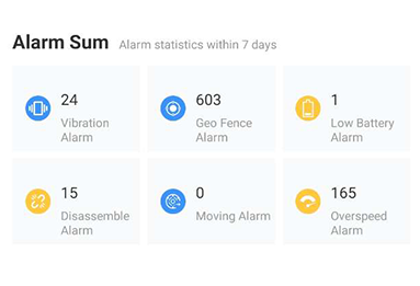
Alarm Notification
Various alarm setting and protecting notification upload

Fuel Detection
Detect vehicle fuel consumption condition

Analysis Report
Collect all the vehicles data and form a visual analysis report

Container Management Partner:
Sum Group
Cooperation results
•Historical walking track tracking.
•Elderly call for help, real-time alarm of various information such as sound, text, picture, etc
•Cross-boundary alarm management
•Reduce the efficiency of elderly accidents